
Table of Contents
If you’re looking for a short but scenic reservoir walk in West Yorkshire, this Baitings Reservoir circular walk near Rishworth and Ripponden is a brilliant option. Tucked just off the A58, the route combines peaceful woodland paths, wide-open moorland views and an impressive crossing of Baitings Viaduct, with the water never far from sight.
The walk is roughly 2 miles long, following clear Yorkshire Water paths around the reservoir before looping back across the dam. It’s an easy, family-friendly route with only gentle inclines, making it perfect for a relaxed afternoon stroll, a leg-stretch on the way over to Lancashire, or a simple short walk near Ripponden. Dogs are welcome too, as long as they’re kept on a lead.
In this guide, you’ll find step-by-step directions for the Baitings Reservoir walk, where to park, how to get there by public transport, and what to look out for along the way – plus safety tips, FAQs and ideas for extending your day to nearby Ryburn Reservoir and the surrounding moorland.
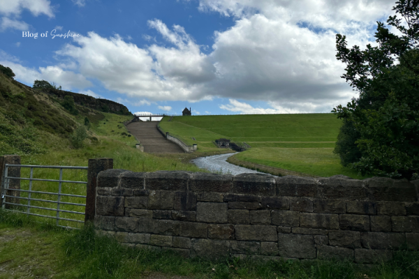
Arriving at Baitings Reservoir Car Park: History & First Views
Your Baitings Reservoir circular walk begins at the Yorkshire Water car park on the A58 above Rishworth. Before you set off, it’s worth pausing at the stone plaque on the dam wall. It records the opening of Baitings Reservoir in 1957 by the Wakefield and District Waterworks Committee and pays tribute to the workers who lost their lives during its construction. It’s a small but powerful reminder of the history hidden beneath the water.
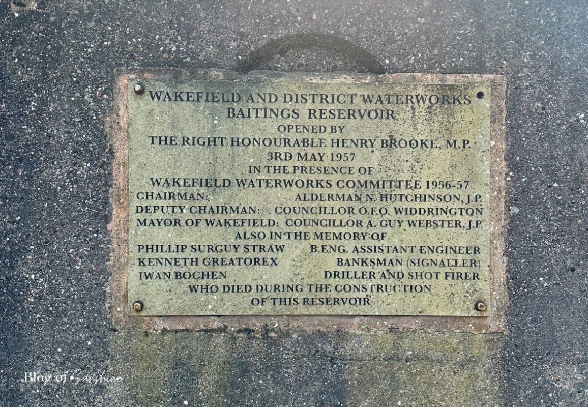
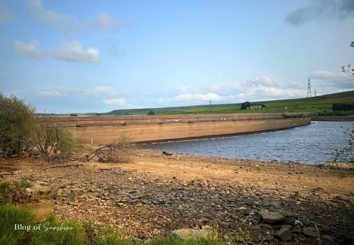
Turn away from the plaque and you’re greeted with your first big view: the huge concrete dam stretching across the valley, backed by rolling moorland and wide Pennine skies. From here you can see exactly where your walk will lead – along the top of the dam and around the water’s edge, making this car park the perfect place to get your bearings, snap a few photos and start your route.
Starting the Baitings Reservoir Circular Walk Along the Dam
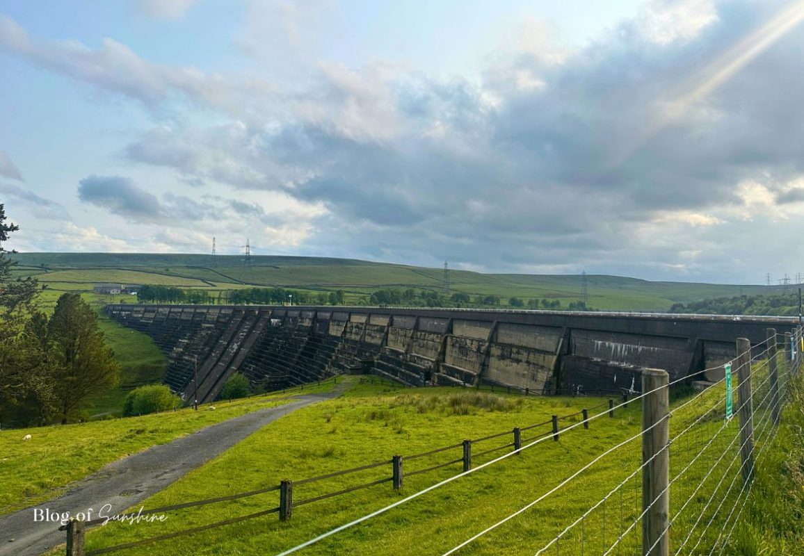
From the car park, head through the gate and step out onto the top of Baitings Reservoir dam. This is the official start of the circular walk and it immediately gives you big views in both directions – moorland hills on one side and the wide stretch of water on the other. The path along the dam is broad and level, with railings on either side, so it’s an easy first section to get your legs moving.
As you walk along the dam, look down to see the old valley floor and tree stumps revealed when water levels are low. On breezy days the wind can really pick up here, so hold on to hats and keep dogs on a short lead. At the far end of the dam you’ll leave the concrete behind and join the quieter reservoir paths that curve around the shoreline.
Halfway Along Baitings Dam: Big Drops and Wide-Water Views
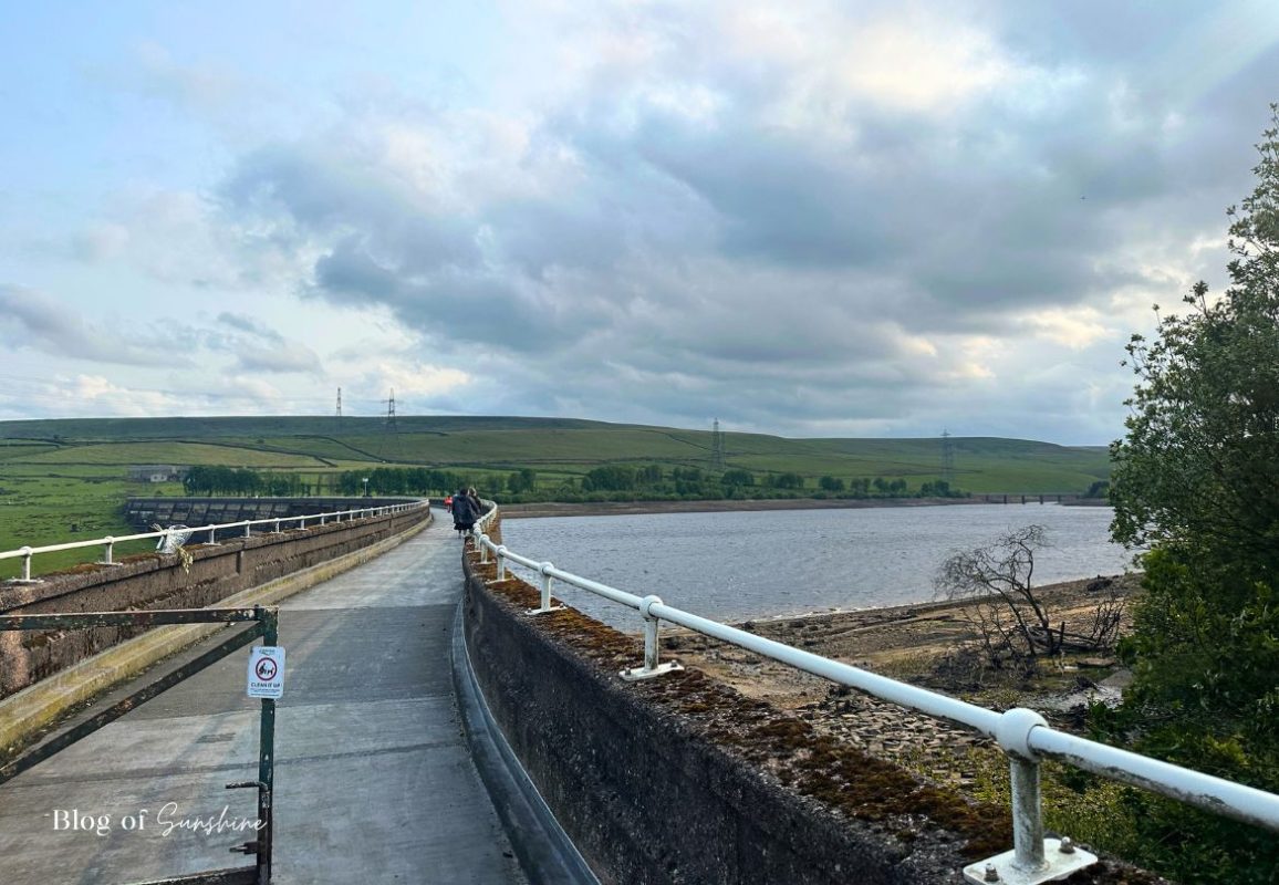
As you get about halfway along the Baitings Reservoir dam, the scale of the place really hits you. The path ahead stretches out between the metal railings, framed by open moorland and the wide sweep of water on your right. It’s still an easy, level surface here, but the views are anything but ordinary.
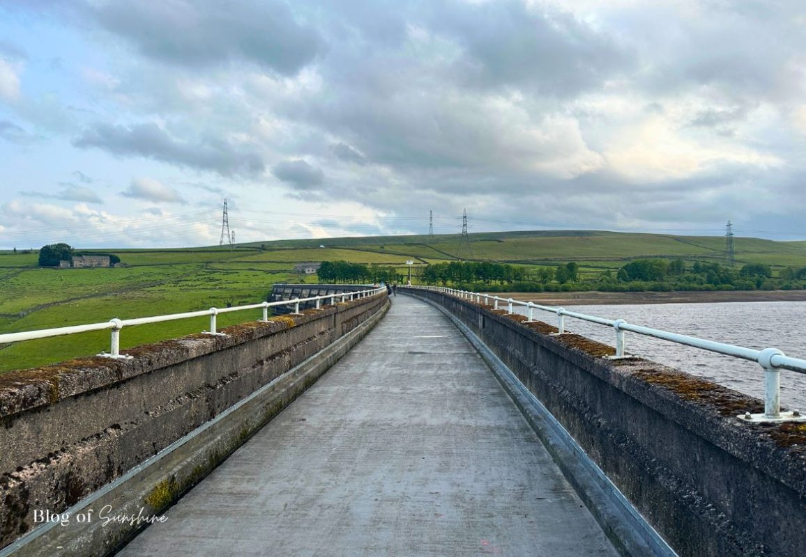
Glance over the left-hand side of the dam and you can see just how high you’re walking. Far below, the spillway, control building and access tracks sit tucked into the steep grassy valley. It’s a fascinating look at the engineering that keeps the reservoir working – but also a reminder to stay well back from the edge and keep dogs and children close.
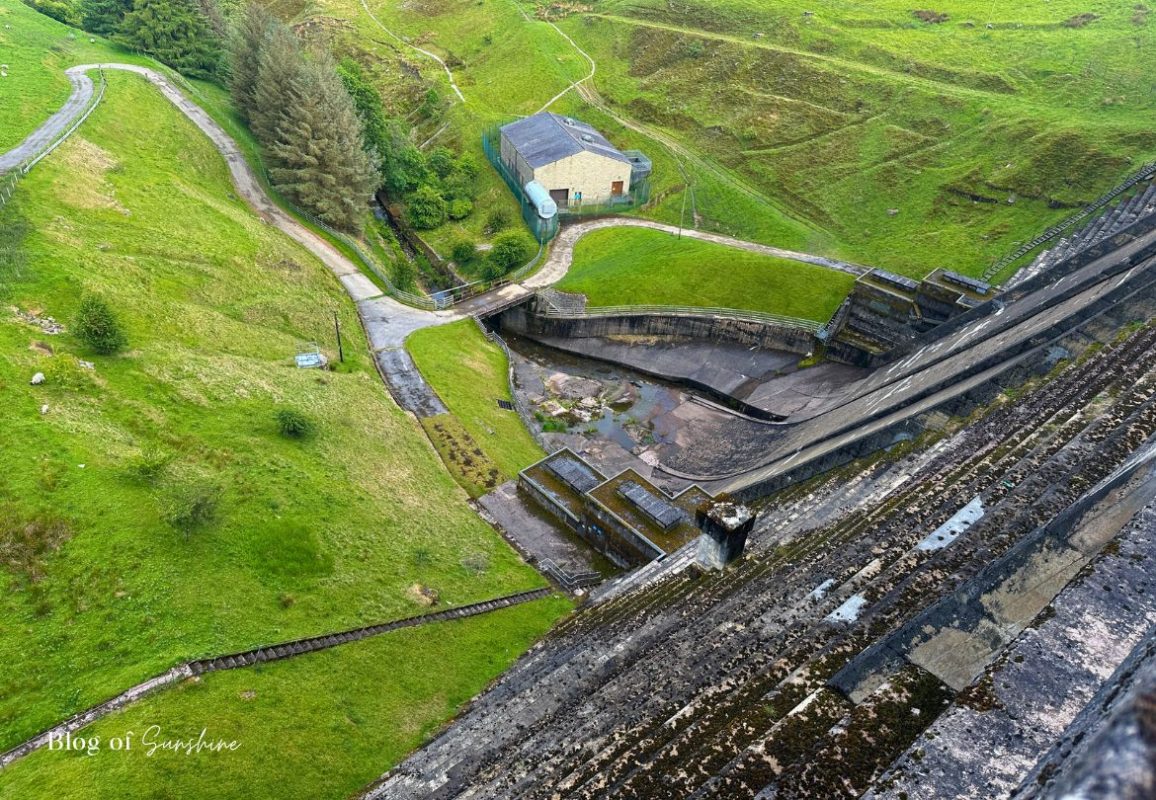
To your right, the reservoir opens out in front of you, with the water often rippling in the wind and the hills rolling away into the distance. On brighter days the light on the surface of the water is beautiful, and it’s a lovely spot to pause for a photo before you continue across the dam to join the shoreline paths.
Leaving the Dam and Joining the Reservoir Path
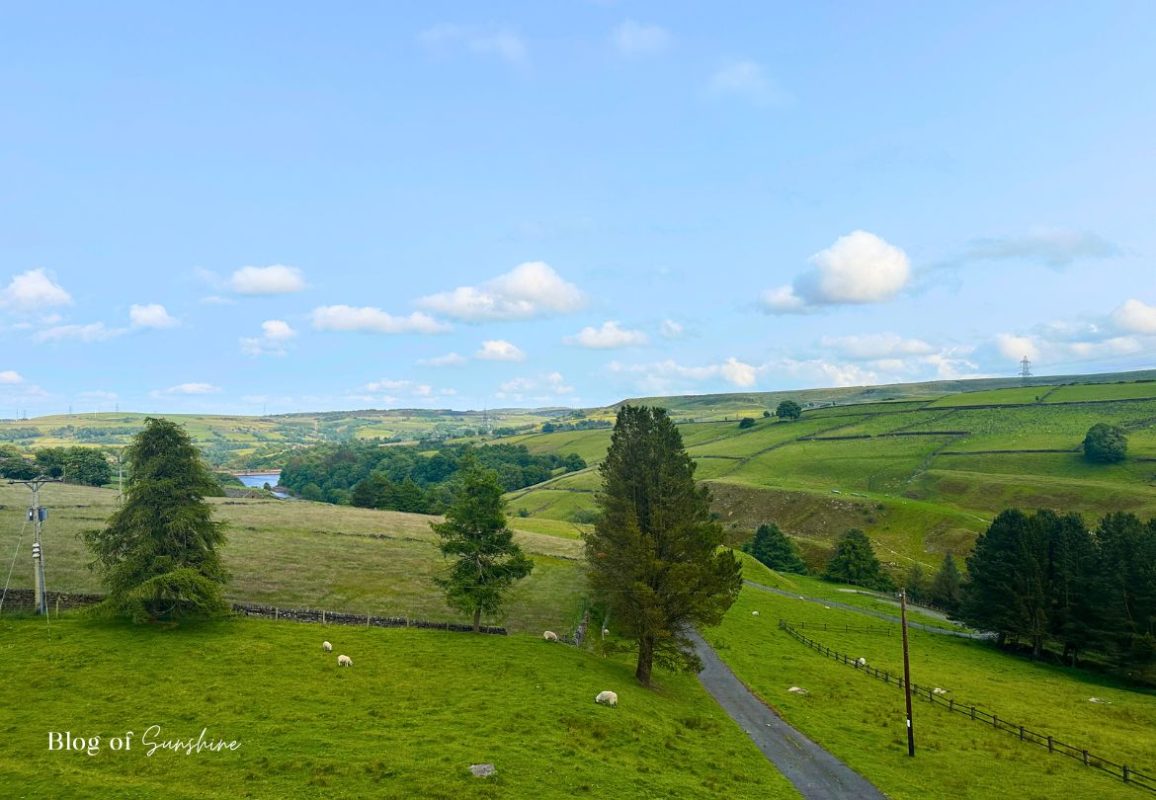
At the far end of Baitings Reservoir dam, the wide concrete walkway finally comes to an end and the landscape opens out again. To your left, the valley drops away with green fields, scattered sheep and long views towards the hills – it’s a lovely outlook, but not the way for this route. Straight ahead a track leads towards what looks like a farmhouse.
For the Baitings Reservoir circular walk, you want to turn right instead. Follow the sloping path that drops away from the dam, curving gently down towards the trees and the shoreline. Very quickly the feel of the walk changes from exposed dam-top to quieter countryside, with the water tucked just out of sight as you head towards the start of the reservoir paths.
Dropping Down to the Water’s Edge
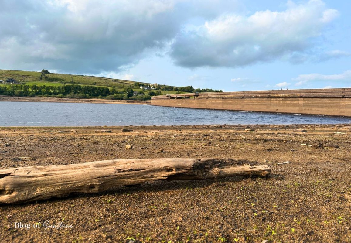
Follow the path down from the dam and you soon reach the shoreline of Baitings Reservoir. When the water level is low, a wide strip of rocky, muddy foreshore is exposed and you get a completely different perspective on the reservoir. From here you can look back to see the huge curve of the dam wall sweeping away in front of you, with green fields and hillside farms beyond.
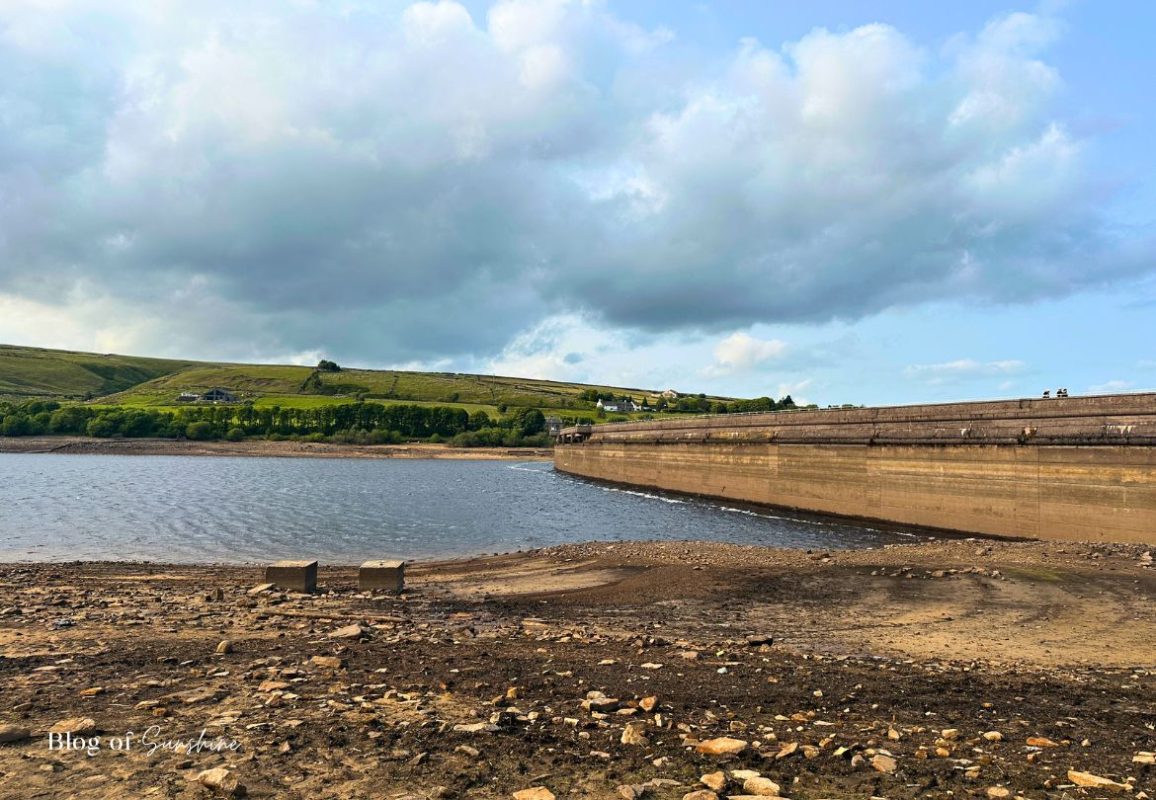
Walking carefully along the edge, you’ll spot patches of shingle, scattered stones and the occasional man-made structure left behind as the water has dropped. A few low concrete blocks sit beside the water here – possibly part of old infrastructure, adding to the sense that there’s a hidden history beneath the surface. It’s a lovely, peaceful spot to pause, listen to the waves lapping against the shore and take in the view of the dam from the opposite side.
Following the Shore Path on the Left Side of Baitings Reservoir
From the shoreline, rejoin the main left-hand path along Baitings Reservoir and continue heading away from the dam. The broad, gravel track winds gently between trees and hedgerows, with glimpses of the water through the greenery. It’s an easy, relaxing stretch of the Baitings Reservoir circular walk, with birdsong in the trees and big skies opening up ahead.
As you go, look out for a marshy area on your right, where reeds and rushes grow thickly in the wet ground. Here, water drains down from the hillside and trickles towards the reservoir, feeding into small channels and pools before it reaches the main body of water. It’s a lovely spot to slow down for a moment and notice how the landscape naturally funnels water into Baitings.
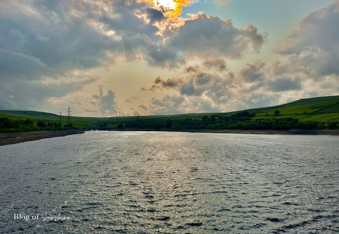
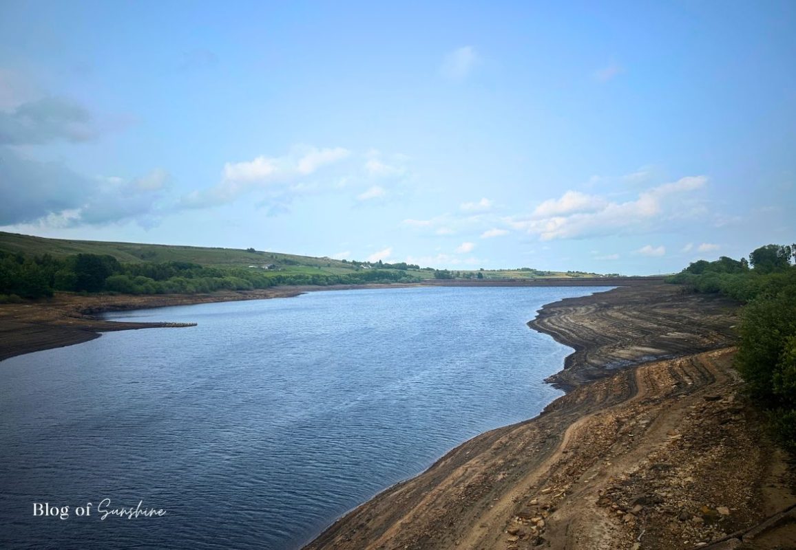
Crossing the Bridge with Wide Views Along Baitings Reservoir
At the end of the shoreline path you rejoin a quiet road and bridge. Turn right to cross over it and you’re suddenly treated to one of the best viewpoints on the whole Baitings Reservoir circular walk. From here you can look right down the length of the reservoir, with the wooded banks on one side and the exposed, layered shoreline curving away on the other.
It can feel very windy and exposed here on blustery days, so hold onto hats and keep a firm grip on phones and cameras. On calmer evenings, though, the water often looks beautifully still, reflecting the sky and moorland hills. It’s well worth pausing on the bridge for a moment just to soak up the view before continuing along the road.
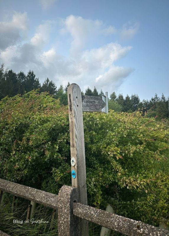
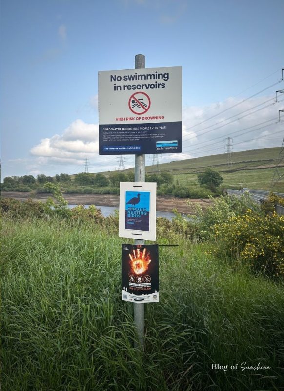
Rejoining the Reservoir Path and Following the Signs
After crossing the bridge, you’ll pick up the main path around Baitings Reservoir again. A wooden footpath sign marks the spot where the route continues, guiding you away from the road and back towards the trees and shoreline. Just alongside it, a cluster of Yorkshire Water safety signs reminds visitors not to swim, to protect ground-nesting birds and to avoid fires on the surrounding moorland.
It’s a useful little checkpoint on the Baitings Reservoir circular walk – you know you’re heading the right way, and you’re reminded how to enjoy the reservoir responsibly before you carry on along the path.
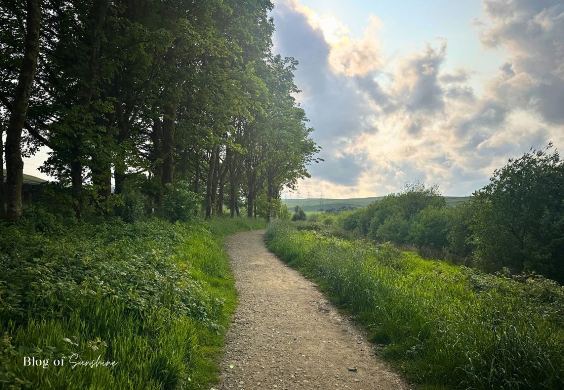
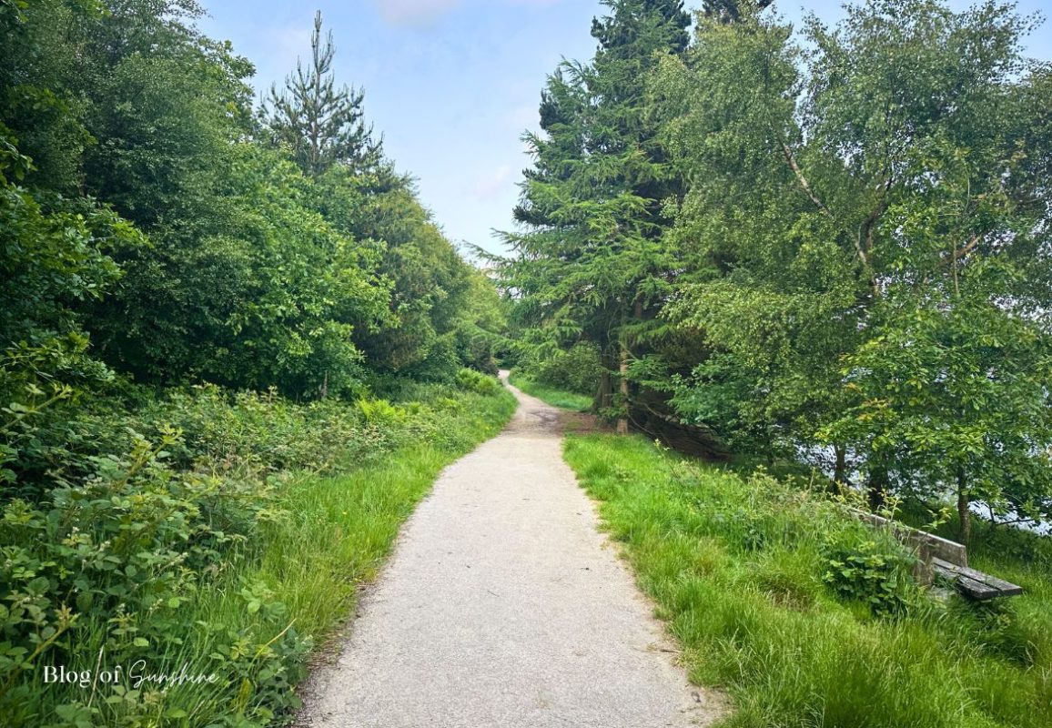
Woodland Path on the Far Shore of Baitings Reservoir
After rejoining the main track, the Baitings Reservoir circular walk continues along the far shore on a more enclosed, woodland section of path. The wide, gravel track winds ahead between trees and thick greenery, with the reservoir mostly hidden below you. This side feels quieter and more sheltered, with benches tucked beside the path where you can stop and enjoy the views back across the Baitings Reservoir walk route.
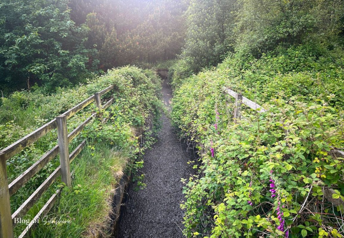
Keep following the path as it twists gently through the trees. Here you’ll cross narrow drainage channels carrying water off the hillside and down towards the reservoir. One of these is lined with wooden railings and overgrown with brambles and wildflowers, a reminder of how much hidden water is constantly feeding into Baitings Reservoir from the surrounding moorland. It’s a lovely, peaceful stretch of the route and adds real variety to this short West Yorkshire reservoir walk.
Glimpses of the Reservoir and Returning to the Car Park
After the more enclosed woodland section and drainage channels, the Baitings Reservoir circular walk slowly begins to open out again. The trees thin and the path runs closer to the edge of the water, giving you your first glimpse of the reservoir through the branches. It’s a lovely surprise moment, with the dam wall and distant hills just starting to come into view between the leaves.
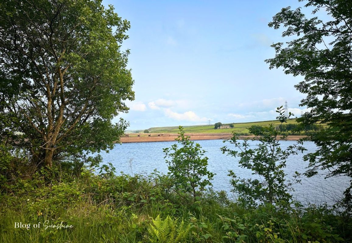
Keep following the path and the views become bigger and clearer. Soon you’re walking beside more open shoreline with a wide, rocky foreshore and a fantastic full view of the sweeping dam wall. From here you can really appreciate the scale of Baitings Reservoir before the track curves round and leads you gently back towards the dam-top car park where the loop began.
Finishing the Baitings Reservoir Circular Walk
The Baitings Reservoir circular walk might be a relatively short loop, but it manages to pack in dam-top drama, peaceful woodland, open shoreline and big Pennine views all in one go. Starting and finishing at the free car park on the A58 near Rishworth, it’s an easy, waymarked route that’s ideal for a relaxed evening stroll, a weekend leg-stretch or a simple West Yorkshire reservoir walk with family, friends or the dog (on a lead).
As with all reservoirs, it’s important to follow the Yorkshire Water safety signs: no swimming or paddling, stay on the paths, keep dogs close and take litter home. Treated with respect, Baitings is a beautiful place to revisit in different seasons – from bright summer evenings to atmospheric winter days with the moorland mist hanging low over the hills.
If you enjoyed this guide, you might also like my other local walks, such as:
Butterley Reservoir circular walk in Marsden, Huddersfield
St Annes to Fairhaven Lake in Fylde
Victorian Greenhead Park in Huddersfield
A short walk to the Sycamore Gap
and even more travel ideas in my blog. Let me know in the comments if you’ve walked Baitings Reservoir, spotted any wildlife on the route, or combined it with nearby Ryburn – I’d love to hear how you got on.
Bonus: Post-Walk Pub Stop – The Malt House, Rishworth
If you fancy a treat after your Baitings Reservoir circular walk, head back towards Rishworth for food and a drink at The Malt House. This characterful stone pub has a big outdoor terrace and garden that’s perfect for sunny days, with plenty of space to sit outside and look back towards the hills you’ve just walked around.
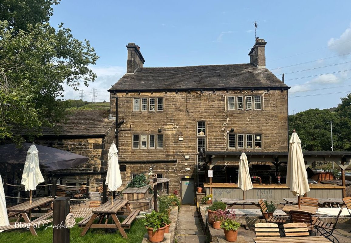
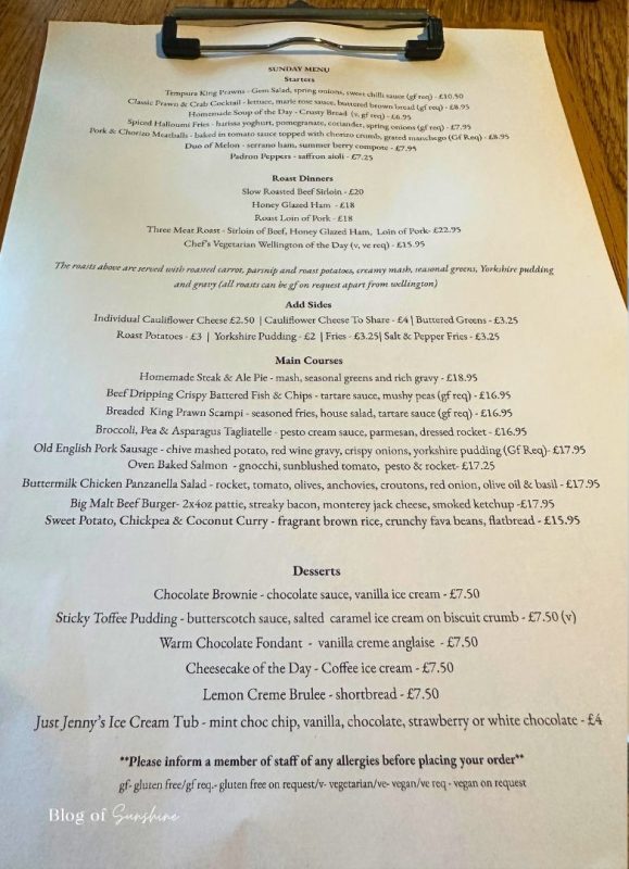
Inside you’ll find a proper sit-down menu rather than basic bar snacks. On Sundays there’s a full roast menu alongside pub classics – think fish and chips, burgers, veggie options and rich puddings – so it’s an ideal spot to refuel after a lap of the reservoir.
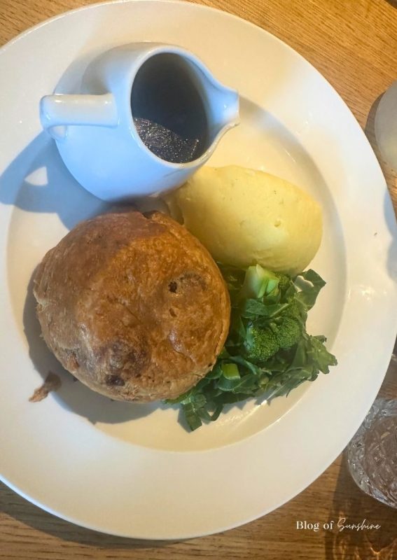
I went for the homemade steak and ale pie, served with mash, seasonal greens and a jug of gravy. The pastry was properly golden and crisp, and the filling was packed with slow-cooked beef – exactly what you want after stretching your legs in the fresh Pennine air.
If you’re planning this walk for a weekend, it’s worth checking opening times and possibly booking ahead, especially if you’re walking with a group or aiming for Sunday lunch.
FAQ – Baitings Reservoir Circular Walk
Where is Baitings Reservoir?
Baitings Reservoir is in West Yorkshire, just above Rishworth and Ripponden.
It sits on the A58 between Halifax and Littleborough, in the South Pennines.
Is there parking at Baitings Reservoir?
Yes. There is a free Yorkshire Water car park right by the dam on the A58
between Ripponden and Littleborough. Spaces are limited at busy times, so
try to arrive earlier in the day if you can.
Does the Baitings Reservoir car park close and get locked?
Yes – the car park has a gate and it is locked. Closing
times can vary and may change seasonally, so always check the sign at the
entrance when you arrive and make sure you are back before the stated time.
If you are planning a late afternoon or evening walk, allow plenty of time
to complete the loop.
How far is the Baitings Reservoir circular walk?
The main circular route around Baitings Reservoir is roughly
2 miles (about 3–3.5 km). It follows the dam, shoreline
paths and a short section of road to complete the loop.
How long does the Baitings Reservoir circular walk take?
Most people complete the full loop in around
1–1.5 hours, depending on pace, weather and how many
photo stops you make along the way.
How difficult is the Baitings Reservoir walk?
The walk is generally classed as easy. Paths are mostly
wide and fairly level with gentle gradients. There are no long climbs, but
there are some uneven sections, kerbs and a short stretch on the road.
Is the walk suitable for children and dogs?
Yes, it is a good family-friendly route with mostly wide, easy paths.
However, there are road sections, a high dam wall and some steep drops,
so children should be supervised closely and dogs must be kept on a lead
at all times.
Are dogs allowed off the lead at Baitings Reservoir?
No – dogs should be kept on a lead around the reservoir.
This helps protect livestock, wildlife and other walkers, and follows
Yorkshire Water’s visitor guidelines.
Can you swim or paddle in Baitings Reservoir?
No. Swimming, paddling and water sports are
not allowed and are dangerous because of cold water,
hidden currents and underwater machinery. Please enjoy the views from
the shore and follow the safety signs.
Are there toilets or a café at Baitings Reservoir?
There are no toilets or café at the reservoir itself.
The nearest facilities are in Ripponden, Rishworth or Littleborough, so
it is worth planning a stop there before or after your walk.
Can you get to Baitings Reservoir by public transport?
Yes. Buses run along the A58 between Ripponden and Littleborough, with
stops close to the Baitings Reservoir car park. Check local timetables
before you travel, especially on Sundays and bank holidays.
Is the route accessible for pushchairs or wheelchairs?
The main paths are generally good and fairly level, but there are some
kerbs, uneven surfaces, short inclines and sections next to the road.
It may be manageable for some all-terrain buggies, but it is not fully
accessible for every wheelchair user.
What is the best time of year to walk Baitings Reservoir?
The walk can be enjoyed all year round. Spring and summer bring greener
hills and longer evenings, while autumn offers colourful trees along the
paths. In winter it can be very cold and exposed on the dam, so dress
warmly and check the weather forecast.
Is Baitings Reservoir very exposed and windy?
The dam and bridge sections are quite exposed and can be
very windy, especially in bad weather. The woodland
paths are more sheltered. A windproof layer and a hat are useful even
on bright days.
Can you cycle around Baitings Reservoir?
The route described here is mainly a walking path. Parts of it are narrow
and shared with pedestrians, so it is best treated as a walking
route rather than a cycle circuit.
Can you combine Baitings Reservoir with Ryburn Reservoir?
Yes. Keen walkers can extend the day by adding a separate walk at nearby
Ryburn Reservoir, which has its own paths and car park.
It makes a great double-reservoir day in the South Pennines.
Is there a pub or place to eat nearby?
Yes – there are several good options in the area. One of the closest is
The Malt House in Rishworth, which serves food and drinks
and makes a lovely post-walk stop after the Baitings Reservoir circular
route.
Is the Baitings Reservoir walk suitable in winter?
You can walk the route in winter, but paths can be icy, muddy and very
exposed on the dam. Wear sturdy footwear, warm waterproof layers and be
prepared to turn back if conditions feel unsafe.
More Things to See and Do in England
If you’re planning more UK adventures, I’ve got plenty of ideas beyond the
Baitings Reservoir circular walk. From coastal escapes and city breaks to
more scenic reservoir and countryside walks, you’ll find lots of inspiration
in my other England travel guides and blog posts. Take a look
at the suggestions below to help you plan your next day out.

St John the Baptist Church, Tideswell (Buxton): Cathedral of the Peak
Visit St John the Baptist Church in Tideswell near Buxton, the “Cathedral of the Peak”. Discover highlights to see inside, a little history, and tips for your visit.
ExploreFeb
Seaham Hall Hotel Review: Luxury Spa Break, County Durham
Planning a luxury spa break in the North East? This Seaham Hall Hotel review covers the Serenity Spa, rooms, dining, prices, and booking tips to get the best deal.
ExploreDec

Things to do in Hexham: A Perfect Day Trip to Northumberland’s Prettiest Market Town
Planning a day trip to Hexham? Discover the best things to do in Hexham, from the Old Gaol and Hexham Abbey to riverside walks, indie shops and Sycamore Gap.
ExploreDec
Baitings Reservoir Circular Walk Near Rishworth: Moorland Views & Viaduct Vistas
Discover an easy 2 mile Baitings Reservoir circular walk near Rishworth and Ripponden, with woodland paths, moorland views and an impressive viaduct crossing. Includes step-by-step directions, parking, public transport info and ideas for extending your walk.
ExploreNov

Autumn Walk St Anne’s to Fairhaven Lake: Driftwood & Shells
Enjoy an autumn walk St Anne’s to Fairhaven Lake with driftwood, shells, beach views and wildlife along this peaceful Fylde Coast route.
ExploreNov
Autumn Walk Greenhead Park Huddersfield – A Victorian Gem
Enjoy an autumn walk Greenhead Park Huddersfield, a Victorian jewel. Discover fall colour, peaceful paths, and hidden heritage.
ExploreNov

10+ Best Things to Do in Seaham, County Durham – Top Attractions, Landmarks & Coastal Experiences
Discover the best things to do in Seaham, County Durham. From the iconic Tommy statue and historic landmarks to stunning beaches, sea glass, and coastal walks — plan your perfect visit to this charming seaside town.
ExploreAug

Seaham Hall Beach Sea Glass: When to Go, What to Find, and Top Collecting Tips
Seaham Hall Beach sea glass is famous worldwide. Find out the best times to visit, what colours to look for, and how to collect it like a pro.
ExploreAug
A Day at Cliffe Castle Keighley: What to See, Do, and Know Before You Go
Discover Cliffe Castle Keighley: Explore the Victorian museum, park, café, and everything you need to plan the perfect day out.
ExploreAug
Butterley Reservoir Circular Walk Marsden: 210 Steps, Mill Views & 6km Scenic Loop
A 6 km circular walk in Marsden with scenic views, industrial heritage, and 210 iconic stone steps beside Butterley Reservoir. A perfect loop for hikers & photographers
ExploreJul
A Day Trip Guide To Tynemouth
Discover the perfect Tynemouth day trip guide, explore historic castles, relax on golden beaches, enjoy fresh seafood, and soak up coastal charm in this vibrant UK seaside town.
12 Comments
ExploreJun

Armathwaite Hall Hotel & Spa, The Lake District
Experience a luxury escape at Armathwaite Hall Hotel & Spa in the Lake District - from elegant rooms and fine dining to one of the best spa experiences in Cumbria.
ExploreJun
A Short Walk to the Sycamore Gap
Discover a short walk to the Sycamore Gap. Follow this scenic trail to see England’s iconic tree and enjoy breathtaking views along Hadrian’s Wall.
ExploreJun
Visiting the Grave of Richard III in Leicester: History, Legacy, and a Remarkable Memorial
Explore the grave of Richard III at Leicester Cathedral, discover the history, legacy, and striking memorial of England’s last Plantagenet king.
ExploreMar